Explore without losing context
Explore countries, places, physical geography, and real-world data layers on an interactive globe and map.

Explore countries, map layers, and geographic patterns with an interactive atlas, adaptive quizzes, and classroom learning tools.
Your geography workspace
Explore countries, places, physical geography, and real-world data layers on an interactive globe and map.
Your geography workspace
Explore countries, places, physical geography, and real-world data layers on an interactive globe and map.
Open the atlas→Map-first learning
Explore countries, places, physical geography, and real-world data layers on an interactive globe and map.
Explore countries, map layers, and geographic patterns with an interactive atlas, adaptive quizzes, and classroom learning tools.
Follow a four-level geography pathway with referenced learning objects, maps, data, vocabulary, and assessments.
Your geography workspace
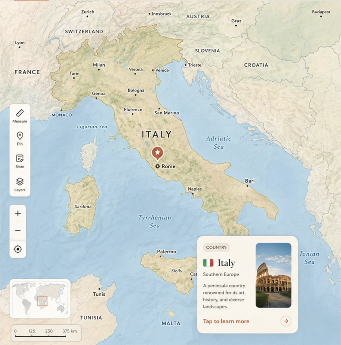
Explore countries, places, physical geography, and real-world data layers on an interactive globe and map.
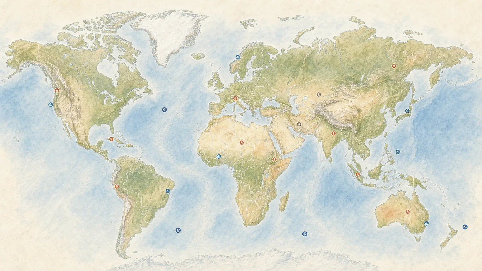
Explore countries, places, physical geography, and real-world data layers on an interactive globe and map.
Explore countries, places, physical geography, and real-world data layers on an interactive globe and map.
Progress
A world worth understanding
A capital, a river, or a mountain range is easier to remember when it belongs to a larger picture. Godwana keeps that picture visible. You can begin with a place you have heard about, move outward to its neighbors and region, and then add the physical and human layers that explain why it developed as it did. The map is not a reward waiting at the end of a lesson. It is the surface on which the lesson happens, so names, shapes, distances, climates, populations, and events remain connected instead of becoming separate lists to memorize. That difference matters over time. When a place appears again in a book, conversation, journey, or headline, it already has somewhere to fit. New information can attach itself to a coastline, a border, a route, or a neighboring country you recognize, making each encounter reinforce the ones before it. The same principle works in reverse: a map can reveal which parts of your understanding are still empty. A country you can name but cannot place, an ocean whose scale surprises you, or a border whose shape you have never examined becomes a useful invitation. Instead of hiding uncertainty behind a list of completed topics, the atlas makes it visible, specific, and approachable. You always know what to look at next and how it connects to something already familiar.
That approach makes room for curiosity. One question can lead naturally to the next: Why are so many cities located near water? Where does a mountain range end? How can two nearby countries have different climates? Which borders follow rivers, and which cut across older cultural regions? Godwana helps you follow those questions without losing your position in the world. When you are ready, the same places become focused quizzes and review sessions, turning open exploration into knowledge you can retrieve later. There is no single correct route through the atlas. You might follow the equator across three continents, compare cities at similar latitudes, trace the watershed of a river, or investigate the countries along a railway. What holds those routes together is the visible world beneath them: every detour adds detail without erasing the context that made the first question meaningful. This also changes the role of a reference map. It is no longer something you consult only to confirm an answer. It becomes a place for thinking: a surface where you can compare possibilities, notice a contradiction, revisit an assumption, and leave with a sharper question. The atlas supports the quiet work between knowing nothing and knowing a fact—the observation, orientation, and connection that make the fact useful beyond a quiz. It rewards looking closely, because even a familiar outline can reveal a new relationship when the scale, layer, or neighboring region changes.
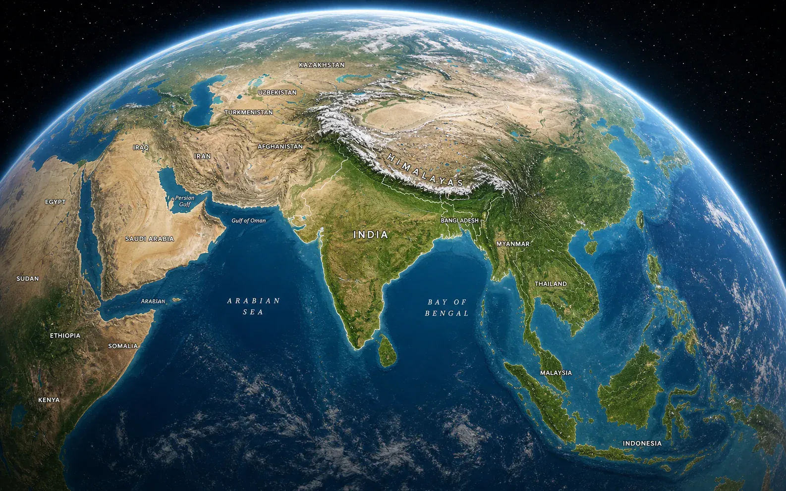
The world is too connected to learn one country at a time in isolation. Godwana begins with a globe you can turn, zoom, and examine from any direction. Continents stay visible while you compare hemispheres; oceans retain their scale while you trace routes between ports; neighboring countries remain present while you focus on one border. As the view gets closer, the atlas reveals more detail rather than replacing one disconnected diagram with another. That continuity helps build a reliable mental map: you remember not only what a place is called, but where it sits, what surrounds it, and how far it is from places you already know. Orientation becomes a habit rather than a separate task. Before learning a new fact, you can locate its hemisphere, continent, region, and nearest familiar reference points. Those repeated acts of placement gradually make the world feel legible instead of enormous and arbitrary.
Scale also changes the questions you can ask. From far away you can see the arc of the Andes, the breadth of the Sahara, or the concentration of land in the Northern Hemisphere. Closer in, you can examine river valleys, urban corridors, islands, provinces, and coastlines. Moving between those scales makes geographical claims easier to test. A pattern that looks simple on a world map often becomes more interesting at regional level, and a local feature can make more sense once you see the continental system around it. Distortion becomes easier to notice too. A familiar flat map can exaggerate high latitudes or split an ocean at its edge; turning the globe restores continuity and encourages you to check how projection, viewpoint, and scale influence the story a map appears to tell.
Maps become explanations when you can compare more than one kind of information. Add terrain to understand why roads and settlements follow certain corridors. Compare climate with vegetation and agriculture. Place population beside coastlines, rivers, elevation, or night-time lights and look for both the expected clusters and the surprising gaps. Each layer answers one question while creating another. Godwana keeps the base geography clear underneath, so the data remains attached to real countries, regions, and physical features rather than floating as an abstract chart. You can turn layers on one at a time to understand what each contributes, then combine them when you are ready to investigate a relationship. Clear legends and consistent geography make comparisons readable instead of letting color and symbols overwhelm the place you are studying.
The value is not simply having more data on screen. It is being able to form a claim, inspect the evidence, and revise the claim when the map reveals an exception. Dense settlement often follows water and accessible terrain, but not always. Political borders sometimes follow mountains or rivers, but history can pull them in different directions. Climate helps explain crops and ecosystems, yet trade and technology change what is possible. By moving between layers, learners practice the kind of careful comparison that turns geography from trivia into a way of interpreting the world. The exceptions are often where the richest learning begins. A bright settlement in an arid region, a linguistic boundary that ignores a national border, or a productive agricultural area at an unexpected latitude invites you to search for irrigation, migration, history, elevation, trade, or another missing part of the explanation.
You do not need to begin with a syllabus heading. Start with a news story, a journey, a family connection, a flag, a food, or a place whose name caught your attention. Locate it, then widen the view. Which region does it belong to? What lies across its borders? Which languages are spoken nearby? What physical features shape travel and settlement? Godwana is designed for these branching paths. The map remains the anchor while saved places, layer choices, and related activities help turn a moment of interest into a coherent exploration. A story about an election can become an investigation of administrative regions and population. A recipe can lead to climate, agriculture, trade routes, and migration. A football match can open a route through cities, languages, and borders. Everyday interests become entrances into serious geographical thinking.
A good atlas should support both wandering and purpose. You can spend a few minutes following coastlines or comparing islands, then choose a focused activity when you want a clearer goal. You can return later and pick up from a saved place instead of reconstructing the route from memory. This rhythm matters because durable learning rarely follows a straight line. It grows through repeated encounters: seeing a place in context, asking a better question, testing your recall, and noticing something new the next time you return. The atlas never demands that every exploration become a test, but it makes a useful next step available. A saved group of places can become a quiz; a weak quiz result can reopen the exact region; a review session can reveal a new pattern worth exploring.
Seeing a label can feel familiar without meaning you could find the place again. Godwana closes that gap by turning the same map into practice. A quiz can ask you to locate a country, identify a capital, distinguish neighboring regions, or work with a themed collection. Because the activity stays spatial, every answer reinforces position and relationship. A missed answer is not reduced to a red mark: it can take you back to the relevant part of the atlas, where you can inspect the surrounding geography before trying again. That return matters. Instead of memorizing an answer in isolation, you can notice the coastline, the neighboring country, the river basin, or the shape that will help you recognize it next time. Feedback becomes another short act of exploration.
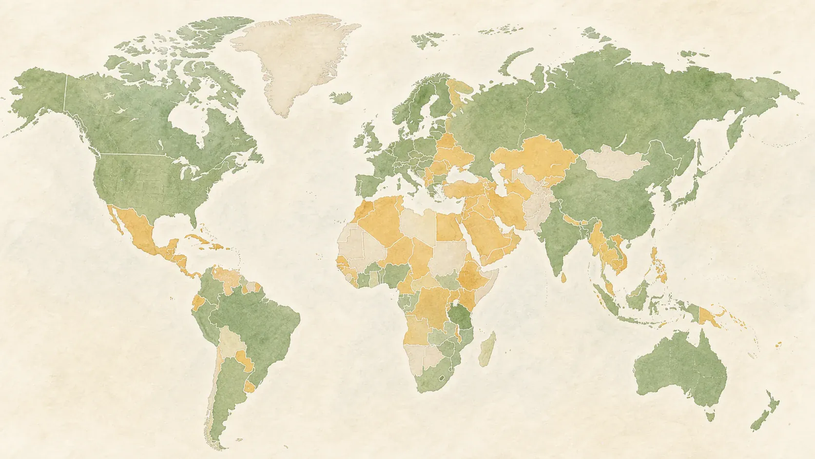
Review is shaped by what you have actually practiced. Places that need attention return sooner, while secure knowledge makes room for new material. The mastery map shows strengths and gaps geographically, which makes progress easier to interpret than a single percentage. You can see whether uncertainty is concentrated in a particular region, whether capitals are stronger than borders, or whether a recently explored collection is beginning to stick. Practice remains connected to the world it describes, and progress becomes an invitation to choose the next meaningful destination. Short sessions can fit between other activities, while longer sessions can concentrate on a continent or theme. The goal is not an endless streak or a perfect score; it is a world map that becomes clearer, more detailed, and easier to call to mind whenever you need it.
Traditional maps are excellent snapshots, but learning needs continuity. Godwana gives each exploration somewhere to go. Save places you want to revisit, group them around a journey or topic, and use those collections as the basis for later practice. A list might begin with countries along the Danube, volcanic islands in the Pacific, cities on the Silk Roads, or places connected to a novel. As it grows, it becomes a personal layer on top of the shared atlas: a record of what has caught your attention and a practical route back into the material. Collections can be small and temporary or become long-running projects. You might prepare the geography of a future trip, trace the origins of objects in your home, collect protected landscapes, or follow every place mentioned during a course.
The result is a workspace that can change with you. A beginner can build confidence with continents, countries, and capitals. A more experienced learner can compare demographic patterns, administrative regions, physical systems, and historical routes. The same world remains underneath, so new detail strengthens rather than replaces earlier knowledge. Godwana is meant to be returned to—not as a finished reference to consult only when you are lost, but as a living atlas in which exploration, explanation, practice, and memory continually support one another. The more you use it, the less the world feels like a catalogue of distant names. Places acquire neighbors, terrain, routes, contrasts, and stories. What began as a map becomes a framework for understanding travel, news, history, environment, culture, and the countless ways one place is connected to another. This accumulated context changes how unfamiliar places feel. You may not know the answer yet, but you know where to begin: locate the region, check its neighbors, inspect the terrain, compare a useful layer, and connect the new place to something already understood. That repeatable approach is more valuable than memorizing a finished list, because it gives you a way to keep learning as the world—and the questions you ask about it—continues to change.
Map-first learning
Explore countries, map layers, and geographic patterns with an interactive atlas, adaptive quizzes, and classroom learning tools.
Godwana
Explore without losing context
Explore countries, places, physical geography, and real-world data layers on an interactive globe and map.
See what you know—and where to travel next
7
Daily review
Mastery map
Follow a four-level geography pathway with referenced learning objects, maps, data, vocabulary, and assessments.
Map-first learning
Explore countries, map layers, and geographic patterns with an interactive atlas, adaptive quizzes, and classroom learning tools.
Open the atlas→